'%3e%3cpath%20fill='red'%20d='M0%200h720v480H0z'/%3e%3cpath%20fill='%23000095'%20d='M0%200h360v240H0z'/%3e%3cg%20fill='%23fff'%3e%3cpath%20d='m154%20126.9-2.5%209.6%209.4%202.6-1.8-7.1zm46.9%205.1-1.8%207.1%209.4-2.6-2.5-9.6zm-41.8-24-5.1%205.1%201.9%206.9z'/%3e%3cpath%20d='m155.9%20120-1.9%206.9%205.1%205.1z'/%3e%3cpath%20d='m154%20113.1-6.9%206.9%206.9%206.9%201.9-6.9zm14%2027.8%205.1%205.1%206.9-1.9zm18.9%205.1%209.6%202.5%202.6-9.4-7.1%201.8z'/%3e%3cpath%20d='m192%20140.9%207.1-1.8%201.8-7.1zm-31.1-1.8%202.6%209.4%209.6-2.5-5.1-5.1zm19.1%205%206.9%201.9%205.1-5.1z'/%3e%3cpath%20d='m173.1%20146%206.9%206.9%206.9-6.9-6.9-1.9zm-12.2-45.1-9.4%202.6%202.5%209.6%205.1-5.1zm-1.8%2031.1%201.8%207.1%207.1%201.8zm45-12%201.9-6.9-5.1-5.1z'/%3e%3cpath%20d='m168%2099.1-7.1%201.8-1.8%207.1zm32.9%208.9-1.8-7.1-7.1-1.8zm5.1%2018.9%206.9-6.9-6.9-6.9-1.9%206.9z'/%3e%3cpath%20d='m200.9%20108-8.9-8.9-12-3.2-12%203.2-8.9%208.9-3.2%2012%203.2%2012%208.9%208.9%2012%203.2%2012-3.2%208.9-8.9%203.2-12z'/%3e%3cpath%20d='m200.9%20132%205.1-5.1-1.9-6.9zm5.1-18.9%202.5-9.6-9.4-2.6%201.8%207.1zm-6.9-12.2-2.6-9.4-9.6%202.5%205.1%205.1zm-26-6.9-9.6-2.5-2.6%209.4%207.1-1.8zm6.9%201.9-6.9-1.9-5.1%205.1z'/%3e%3cpath%20d='m186.9%2094-6.9-6.9-6.9%206.9%206.9%201.9z'/%3e%3cpath%20d='m192%2099.1-5.1-5.1-6.9%201.9zM173.1%20146l-9.6%202.5%204.5%2016.6%2012-12.2zm-5.1%2019.1%2012%2044.9%2012-44.9-12-12.2zm-7.1-26-9.4-2.6-4.4%2016.4%2016.4-4.4z'/%3e%3cpath%20d='m147.1%20152.9-12%2045.1%2032.9-32.9-4.5-16.6zm-12-20.9L102%20165.1l45.1-12.2%204.4-16.4z'/%3e%3cpath%20d='m154%20126.9-6.9-6.9-12%2012%2016.4%204.5zm0-13.8-2.5-9.6-16.4%204.5%2012%2012z'/%3e%3cpath%20d='M135.1%20108%2090%20120l45.1%2012%2012-12zm90%2024-16.6%204.5%204.4%2016.4%2045.1%2012.2z'/%3e%3cpath%20d='m199.1%20139.1-2.6%209.4%2016.4%204.4-4.4-16.4zm-12.2%206.9-6.9%206.9%2012%2012.2%204.5-16.6zm19.1-19.1%202.5%209.6%2016.6-4.5-12.2-12z'/%3e%3cpath%20d='m192%20165.1%2033.1%2032.9-12.2-45.1-16.4-4.4zm7.1-64.2%209.4%202.6%204.4-16.4-16.4%204.4z'/%3e%3cpath%20d='M225.1%20108%20258%2075.1l-45.1%2012-4.4%2016.4zm-12.2-20.9L225.1%2042%20192%2075.1l4.5%2016.4zm12.2%2044.9%2044.9-12-44.9-12-12.2%2012z'/%3e%3cpath%20d='m206%20113.1%206.9%206.9%2012.2-12-16.6-4.5zm-38-38L135.1%2042l12%2045.1%2016.4%204.4z'/%3e%3cpath%20d='m160.9%20100.9%202.6-9.4-16.4-4.4%204.4%2016.4z'/%3e%3cpath%20d='m147.1%2087.1-45.1-12%2033.1%2032.9%2016.4-4.5zm39.8%206.9%209.6-2.5-4.5-16.4-12%2012z'/%3e%3cpath%20d='M192%2075.1%20180%2030l-12%2045.1%2012%2012z'/%3e%3cpath%20d='m173.1%2094%206.9-6.9-12-12-4.5%2016.4z'/%3e%3c/g%3e%3ccircle%20cx='180'%20cy='120'%20r='51.1'%20fill='%23000095'/%3e%3ccircle%20cx='180'%20cy='120'%20r='45.1'%20fill='%23fff'/%3e%3c/g%3e%3c/svg%3e)
'%20d='m0%200%2016%2011h61%2061%2061%2061%2060L47%2037h61%2061%2060%2061L16%2063h61%2061%2061%2061%2060L47%2089h61%2061%2060%2061L16%20115h61%2061%2061%2061%2060L47%20141h61%2061%2060%2061L16%20166h61%2061%2061%2061%2060L47%20192h61%2061%2060%2061L16%20218h61%2061%2061%2061%2060L0%200'/%3e%3c/svg%3e)

'%20d='M-50-12v24m6%200v-24m6%200v24m76%200V1m0-2v-11m6%200v11m0%202v11m6%200V1m0-2v-11'/%3e%3cpath%20transform='rotate(-33.69006752598)'%20d='M-50-12v24m6%200V1m0-2v-11m6%200v24m76%200V1m0-2v-11m6%200v24m6%200V1m0-2v-11'/%3e%3c/g%3e%3cg%20transform='rotate(33.69006752598)'%3e%3cpath%20fill='%23cd2e3a'%20d='M12%200a18%2018%200%2011-36%200%2024%2024%200%201148%200'/%3e%3cpath%20fill='%230047a0'%20d='M0%200a12%2012%200%201124%200%2024%2024%200%2011-48%200%2012%2012%200%201024%200'/%3e%3c/g%3e%3c/svg%3e)


Kyushu Loop Road Trip: A 5-Day Itinerary Through Yufuin, Beppu and Aso

GoodCars works with local Japanese suppliers, and Kyushu is one of the most requested self-drive destinations we handle. The reason is simple: from Fukuoka Airport, all seven prefectures sit within a day's drive, and the three headline areas — Yufuin, Beppu and Aso — happen to fall along the same arc. Yet most first-time itineraries are built as radial day trips out of Fukuoka, which means driving the same expressway three or four times and losing an entire day to backtracking.
Documents, insurance and general rental mechanics are already covered in the GoodCars Complete Guide to Renting a Car in Japan, and the wider Kyushu rental decision — including the regional expressway pass — is covered in the Kyushu Car Rental Guide. This article does not repeat either. It does one thing: turn five days into an actual loop, so you always drive forward and never double back.
- Drive the loop counter-clockwise: Fukuoka → Yufuin → Beppu → Aso → Kumamoto → Fukuoka
- Roughly 520 km total, averaging about 1.5 hours of driving per day; the longest day is under 3 hours
- The Yamanami Highway runs about 52 km, topping out at Makinoto Pass at roughly 1,330 m — and it fogs over regularly
- Yufuin to Beppu takes about 20 minutes by expressway for around ¥810, so this leg does not need the expressway at all
- Access to the Mount Aso crater is never guaranteed — it closes whenever the volcanic alert level rises, so build a Plan B
Why GoodCars recommends driving the Kyushu loop counter-clockwise
Both directions work, but the difficulty lands in very different places. GoodCars recommends counter-clockwise: leave Fukuoka Airport heading southeast to Yufuin and Beppu, cut southwest across the Aso highlands into Kumamoto, then run north on the Kyushu Expressway back to the airport. Three reasons, all about where the hard driving falls.
- The hardest leg lands mid-trip. Beppu to Aso is the only sustained mountain road on the route, and counter-clockwise puts it on the morning of day three, when you are rested and the light is good
- The final day is pure expressway. Kumamoto to Fukuoka is a straight, simple run — no mountain roads on the day you cannot afford to be late
- Onsen towns come first. Yufuin and Beppu are stay-and-soak destinations; putting them on nights one and two lets you recover from the flight
Clockwise is not wrong, but you would tackle a long expressway run on day one — jet-lagged and not yet used to driving on the left — and finish with a long drive from Beppu back to Fukuoka on your return day. GoodCars advises against loading long distances onto the first and last days of any Japan itinerary.
The five-day framework: daily distances and where to sleep
Here is the skeleton. Distances and times are typical-traffic estimates, meant for planning proportions rather than exact scheduling.
| Day | Leg | Distance | Driving time | Overnight |
|---|---|---|---|---|
| Day 1 | Fukuoka Airport → Yufuin | approx. 122 km | approx. 1 hr 45 min | Yufuin |
| Day 2 | Yufuin → Beppu | approx. 25 km | approx. 20–35 min | Beppu |
| Day 3 | Beppu → Aso via the highlands | approx. 100 km | approx. 2.5–3 hrs | Aso area |
| Day 4 | Aso → Kumamoto City | approx. 51 km | approx. 1 hr 15 min | Kumamoto City |
| Day 5 | Kumamoto → Fukuoka Airport | approx. 107 km | approx. 1.5 hrs | — |
That is roughly 520 km spread across five days — about ninety minutes behind the wheel on an average day. This is exactly what the loop buys you. Basing yourself in Fukuoka and returning each night would add close to six hours of pure backtracking over the same trip.
Day 1: Fukuoka Airport pickup to Yufuin — treat it as a transfer day

The classic day-one mistake is treating your landing time as the start of sightseeing. Rental counters at Fukuoka Airport are concentrated in the international terminal, and pickup usually involves a shuttle to the branch office. Add immigration, baggage, paperwork and the vehicle walk-around, and 60 to 90 minutes from touchdown to actually driving away is the realistic figure. GoodCars covers the terminal layout and shuttle details in the Fukuoka Airport car rental guide.
From there it is the Kyushu Expressway then the Oita Expressway southeast, about 1 hour 45 minutes to Yufuin. A stop near Dazaifu or at a highway service area fits neatly, but do not add a second major sight on day one — you want to arrive before dark.
Day 2: Yufuin to Beppu — the shortest day, so skip the expressway

Yufuin to Beppu is barely a drive. The Oita Expressway covers the roughly 25 km in about 20 minutes for around ¥810 in tolls; surface roads take maybe fifteen minutes longer. GoodCars suggests taking the surface route — the time saved on the expressway is marginal, and the ordinary road climbs through the hills near Lake Shidaka, which is a preview of the scenery to come.
Because the drive is so short, day two belongs entirely to Beppu. The hot spring sites sit close together, most have their own parking, and this is the one day on the loop with no clock pressure at all. Take a slow breakfast in Yufuin and leave whenever you like.
- Fill the tank. Fuel stations thin out noticeably in the highlands; Beppu is your easiest resupply
- Pre-load tomorrow's route. Check the navigation is routing over the highland road, not around it on expressways
- Check the volcano. Look up the Aso crater access status tonight so you know whether to plan the summit road tomorrow
Day 3: Beppu across the highlands to Aso — the best driving of the trip

Day three is the leg GoodCars would never compress. The Yamanami Highway runs roughly 52 km from Mizuwakare Pass to Ichinomiya in Aso, crossing the Kuju highland grasslands and ridgelines, with its high point at Makinoto Pass at about 1,330 m. Adding the climb out of Beppu and the viewpoints you will inevitably stop at, budget 2.5 to 3 hours.
The road itself is not technically demanding — wide enough, gentle curves, good surface. The variable is weather.
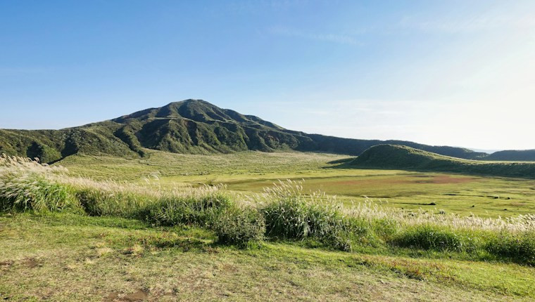
Once you drop into the Aso caldera, the Milk Road along the northern outer rim and the Daikanbo viewpoint are the two classics. Daikanbo is the highest point on the outer rim at roughly 936 m, and it takes in the five peaks of Aso and the whole caldera basin in one view — the single spot on this itinerary most worth extra time.
Day 4: Aso to Kumamoto — the crater is a variable, so carry a Plan B

GoodCars has to be direct about this: the Nakadake crater at Mount Aso is not always accessible. Entry restrictions follow the volcanic alert level, and once the level rises to restricted-entry status, everything within roughly two kilometres of the crater is closed and the Aso Volcano Museum Road to the summit shuts with it. At the time of writing, that restriction is in force and crater viewing is suspended.
| Item | Detail |
|---|---|
| Summit toll road (standard car) | approx. ¥1,000 |
| Crater viewing itself | Free — you pay only for the road |
| Operating hours | Seasonal; broadly 8:30/9:00 am to 5:00–6:00 pm |
| Health restriction | Volcanic gas is hazardous; visitors with asthma, bronchial or heart conditions are turned away |
So the right approach on day four is check first, decide second. Confirm the day's restriction status before you set off; go up if it is open, and if not, switch to the Kusasenri grasslands, the Milk Road and the outer-rim viewpoints, or simply move toward Kumamoto earlier. Treat the crater as a bonus rather than a fixed booking and the day cannot be derailed.
Head for Kumamoto in the afternoon — about 51 km and roughly 1 hour 15 minutes on surface roads. This corridor was closed for years after earthquake damage and traffic detoured a long way around; the replacement route has since opened and cut that detour dramatically, so it is a straightforward drive today.

Day 5: Kumamoto back to Fukuoka Airport — working backwards from your flight

The last day has exactly one job: return the car on time. Kumamoto to Fukuoka Airport is about 107 km and roughly 1.5 hours on the Kyushu Expressway. The route is simple; the only things to watch are Fukuoka's rush hour and the surface streets on the final approach to the airport.
GoodCars suggests working backwards like this:
| Step | Allow | Notes |
|---|---|---|
| Kumamoto → Fukuoka Airport branch | 1.5–2 hrs | Take the upper figure in rush hour or rain |
| Refuelling, if not done last night | 15–20 min | Airport-area stations queue in the morning |
| Return paperwork and fuel check | 10–20 min | Longer in peak season |
| Branch → terminal shuttle | 10–20 min | Fixed departures; miss one and you wait |
| Check-in, bags, security | 60 min or more | Add time for international departures |
| Total: arrive at the branch this far before departure | approx. 3 hrs | Early flight? Fill the tank the night before |
One more thing that catches people out: branch opening hours. Rental offices across Kyushu typically close in the early evening, and it is the office — not the airport curfew — that strands travellers. If you are flying out late at night, confirm the return arrangement with GoodCars in advance.
- The tolled sections are the Oita Expressway and the Kyushu Expressway, plus short urban connector roads
- Rent an ETC card with the vehicle. You keep moving through the ETC lanes and the rates beat cash
- Kyushu has an expressway pass aimed at overseas visitors, but it must be arranged when you book or collect the car — it cannot be added later — and certain roads are excluded. GoodCars breaks down eligibility and whether it actually pays off in the Kyushu Car Rental Guide
Frequently asked questions
Q1. Is five days enough for the Kyushu loop, or is it rushed?
It is comfortable. On this plan you average about 1.5 hours of driving a day and the longest day stays under 3 hours. It only becomes rushed in two situations: insisting on returning to Fukuoka every night, or trying to squeeze Kagoshima or Takachiho into the same trip. The first doubles your driving; the second needs extra days.
Q2. Does the direction really matter?
Clockwise works, but it puts the long drives on day one — jet-lagged and new to driving on the left — and on the return day, when being late is expensive. GoodCars recommends counter-clockwise so the mountain road sits mid-trip and the simple expressway run covers your flight day.
Q3. Can I really skip the expressway between Yufuin and Beppu?
Yes. The expressway takes about 20 minutes and around ¥810 in tolls; the surface road adds maybe fifteen minutes and gives you hill scenery instead. Unless your day is tightly packed, the ordinary road is the better trade.
Q4. What do I do on day four if the crater is closed?
The Kusasenri grasslands, the Milk Road along the northern outer rim and the Daikanbo viewpoint are all unaffected by crater restrictions and are just as photogenic. You can also simply shift forward and spend longer in Kumamoto. The key is checking the status before you set off rather than discovering it at the toll gate.
Q5. Are fuel stations easy to find on this route?
In towns and at service areas, yes. In the highlands, station density drops noticeably and some close early. The GoodCars rule of thumb is: fill up before leaving Beppu, top up again before leaving Aso, and refuel whenever the gauge drops below half rather than gambling on the next interchange.
Q6. Does this route work with older travellers or young children?
Very well. There are no long continuous driving stints, every day ends at a defined base, and the accommodation is mostly onsen ryokan, so rest quality is high. The one caveat is day three, where elevation changes are pronounced — anyone prone to motion sickness should sit up front and take frequent stops.
Q7. What licence do I need to drive in Japan?
Most visitors need an International Driving Permit issued under the 1949 Geneva Convention, carried together with the original home licence and passport. Permits issued in the Vienna Convention format are not accepted in Japan. A small group of countries — Switzerland, Germany, France, Belgium, Monaco, Estonia and Taiwan — instead use the original licence plus an official Japanese translation. You may drive for up to one year from your date of entry, and never beyond the validity of the underlying licence.